
Geo-Economica Software Profile
Geo-Economica is a next-generation spatial economic analysis software designed to empower researchers, policymakers, planners, and development practitioners with the ability to visualize, analyze, and interpret economic phenomena through a spatial lens. Developed by Fitzgerald Witika, the CEO of Research Expert Solutions, the software is a response to the growing need for analytical tools that integrate geospatial intelligence with economic data to support evidence-based decision-making. With a sleek interface, powerful visualization capabilities, and comprehensive project management features, Geo-Economica is transforming how spatial economic patterns are understood, monitored, and applied to real-world challenges.

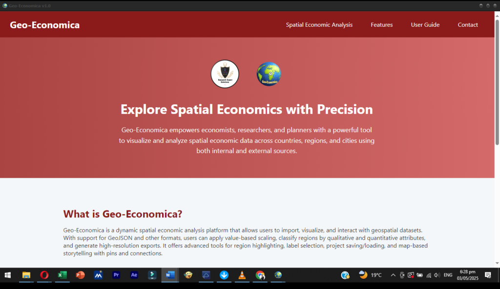
At its core, Geo-Economica enables users to overlay economic indicators on geographic maps and perform complex analyses by linking location-based data with socioeconomic variables. The software is built with the principle that spatial dynamics—such as regional disparities, infrastructure access, urban-rural divides, and economic connectivity—play a critical role in shaping development outcomes. Geo-Economica fills a long-standing gap in the analytical ecosystem by providing a tool that not only supports economic diagnostics but also helps stakeholders identify spatial inequalities and prioritize geographically-targeted interventions.
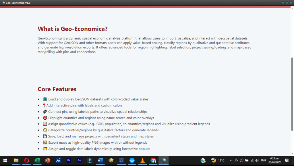
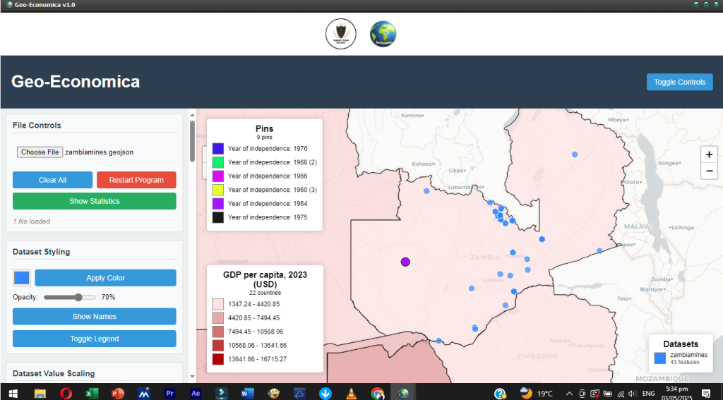
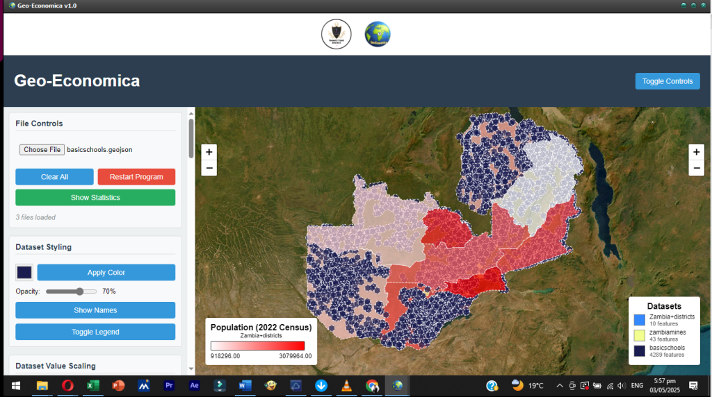
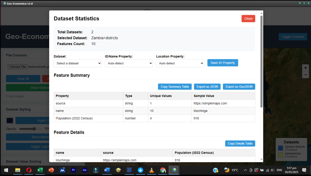
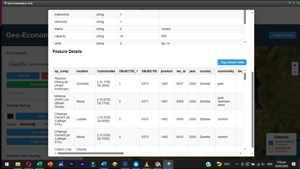
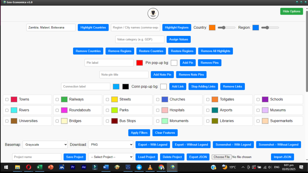
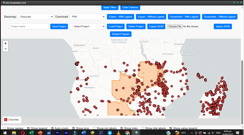
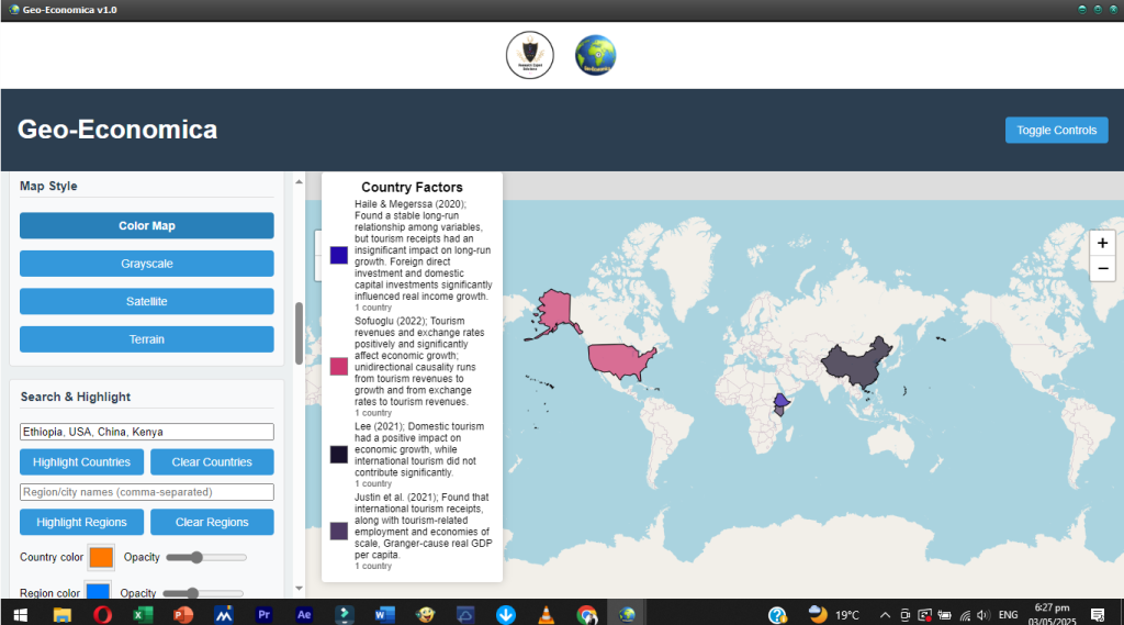
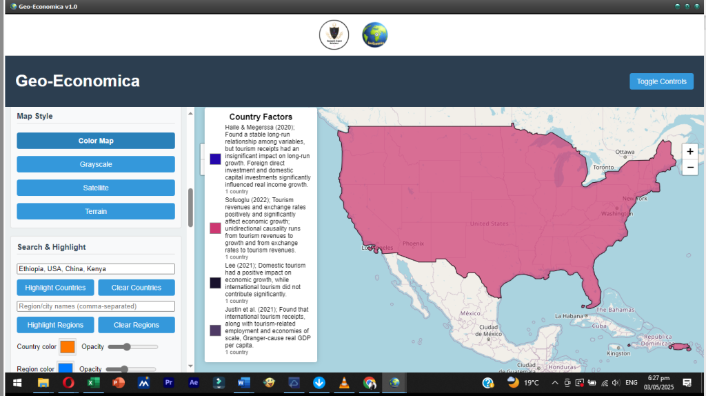
One of the key strengths of Geo-Economica lies in its versatility and ease of use. The software supports the importation of internal data (such as custom GeoJSON files from surveys, government records, or institutional data warehouses) and external data (such as live economic indicators from APIs or open databases). Once loaded, users can style datasets, assign values, highlight regions, and generate visual outputs with high precision. Through intuitive point-and-click interactions, even users with limited technical backgrounds can perform spatial analysis, identify economic clusters, compare regional performance, and draw actionable insights.
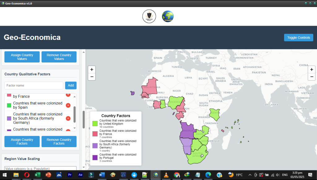
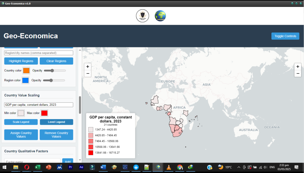
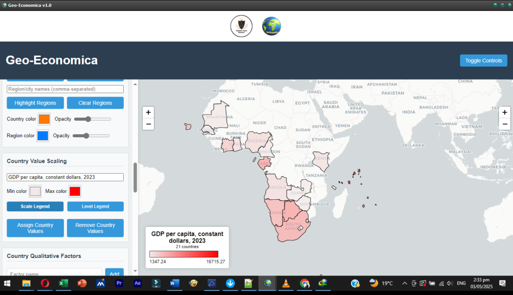
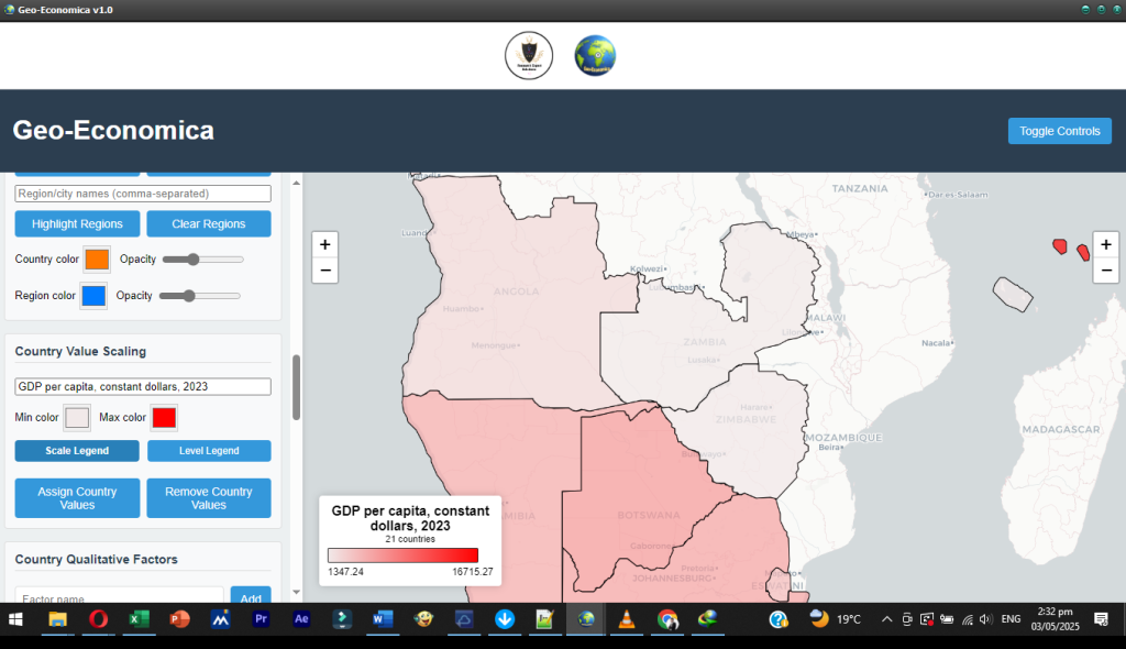
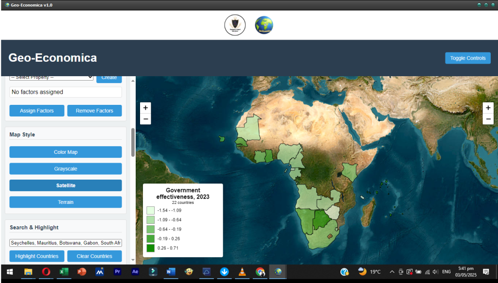
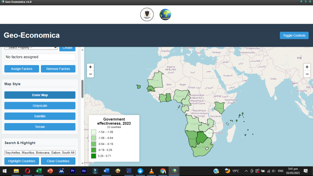
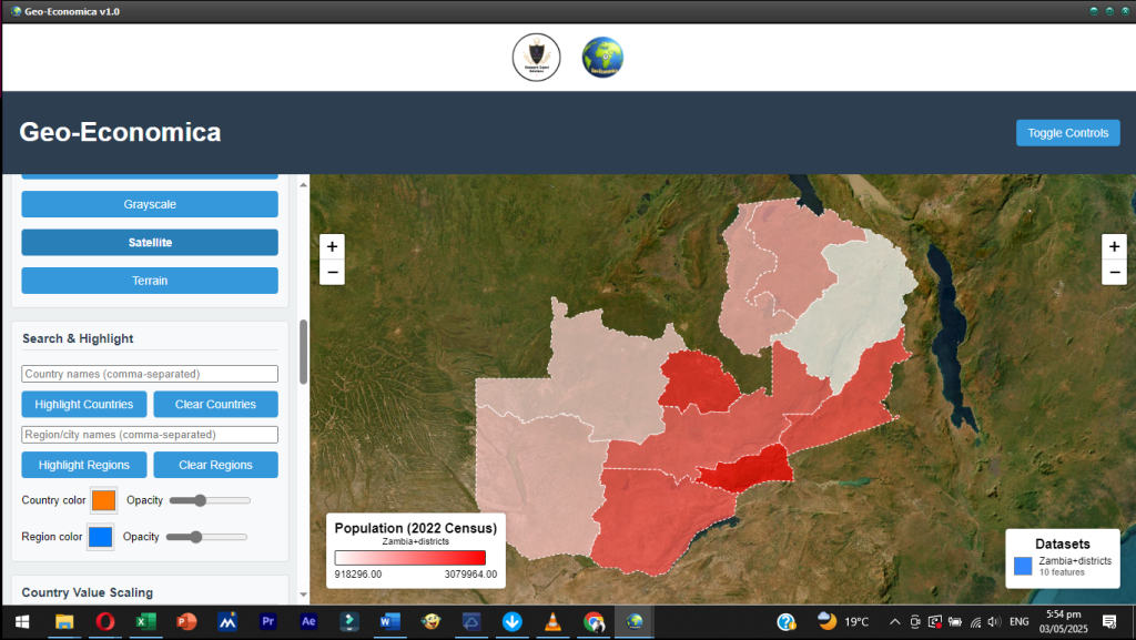
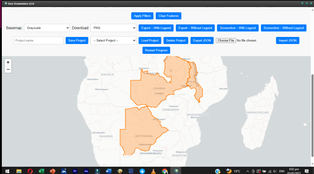
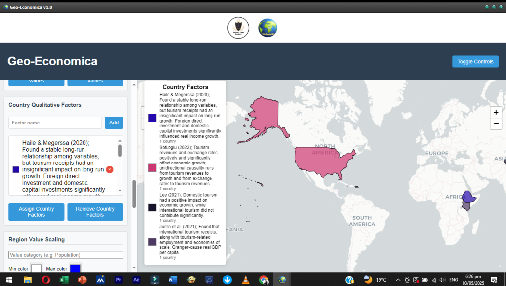
Geo-Economica is particularly powerful when applied in national and regional planning contexts. Ministries of Finance, Economic Planning, Infrastructure, Education, and Health can leverage the software to map service delivery gaps, budget allocations, or economic potential by district or province. For example, users can import economic output data by province, assign quantitative values such as Gross Domestic Product (GDP) or employment levels, and view spatial gradients that reveal areas of underperformance or high productivity. Qualitative factors—such as regional economic zones, industrial corridors, or poverty categories—can also be added and color-coded to communicate policy zones or intervention typologies. This multi-layered mapping approach allows for a holistic view of spatial economics and helps institutions to align resource allocations with actual needs.
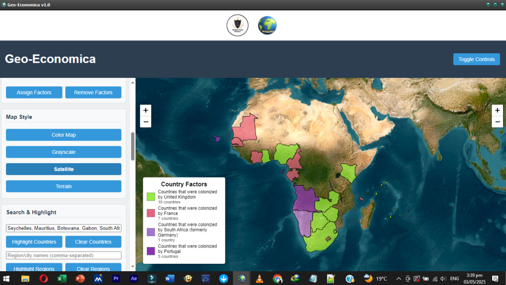
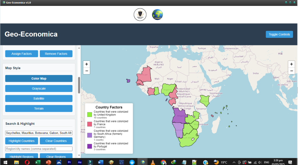
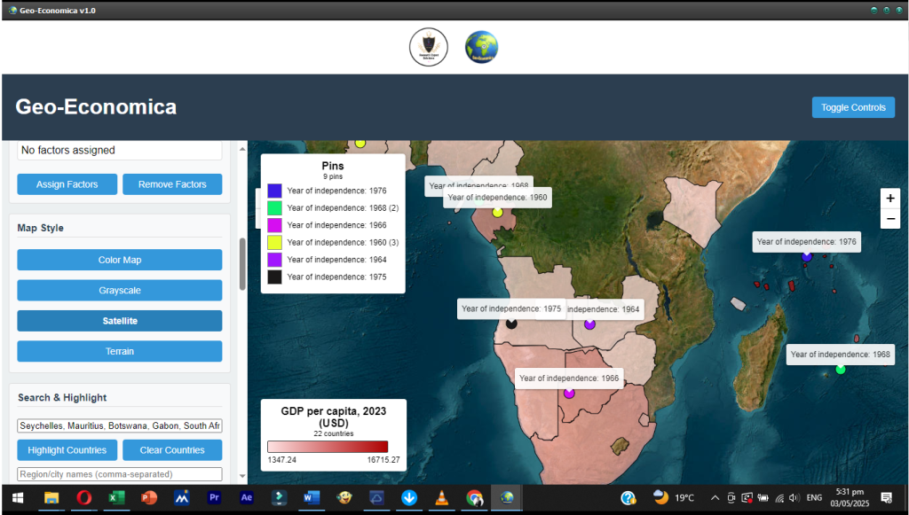
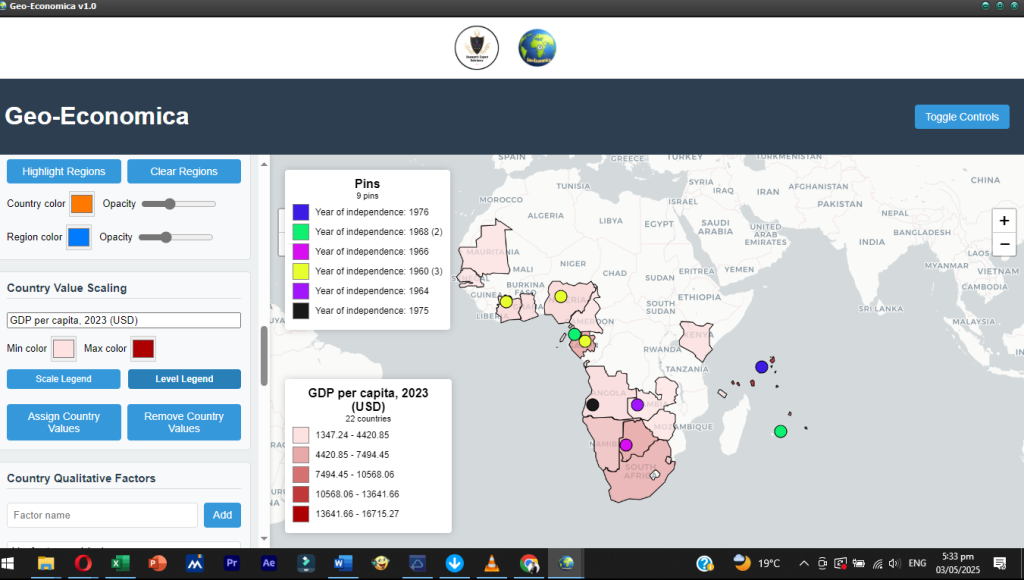
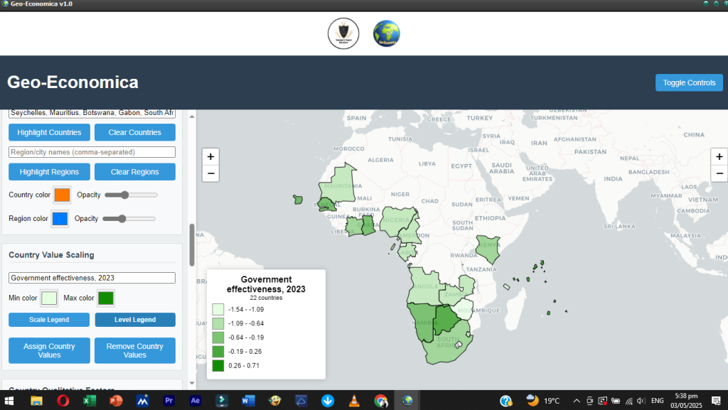
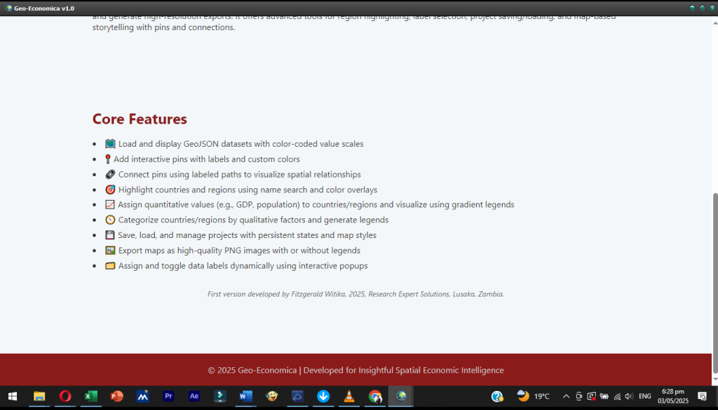
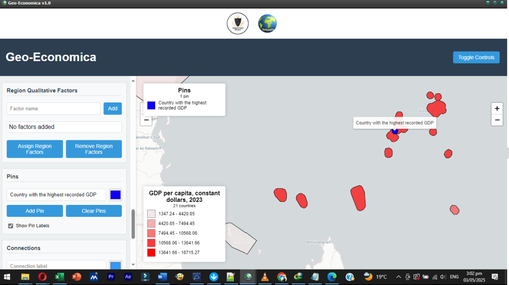
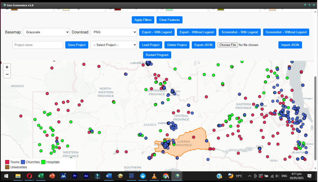
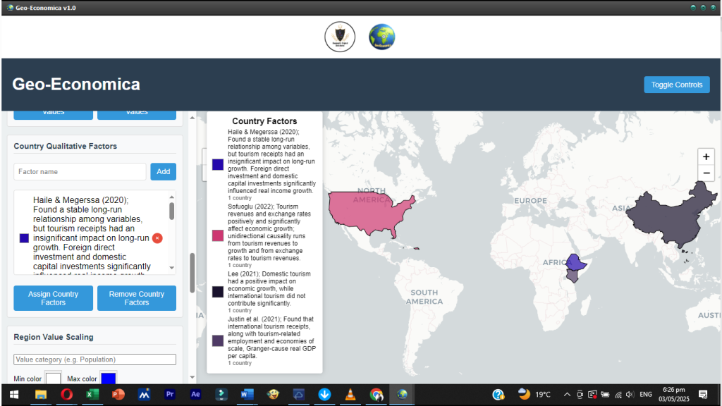
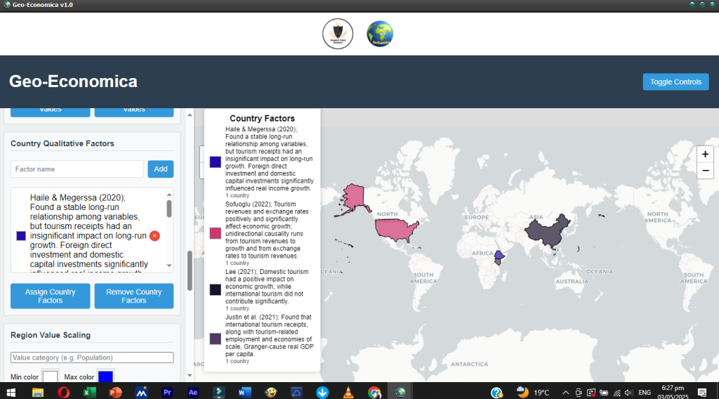
Among its standout features is the ability to assign value-based color scales, which are particularly useful for comparing regions based on economic indicators such as income levels, health coverage, agricultural productivity, or tax contributions. This is complemented by qualitative factor assignment, which allows users to classify regions by categories such as “urban,” “peri-urban,” or “rural,” or by development program participation status (e.g., “beneficiary” vs. “non-beneficiary”). These features enhance comparative analysis and make it easier to explain spatial dynamics in development outcomes.
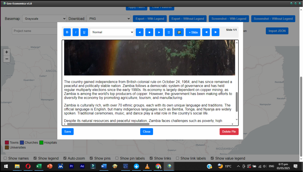
The software also introduces interactive pins and connections, enabling users to tell spatial economic stories. For example, an analyst might place pins to represent economic hubs (such as Lusaka, Ndola, or Livingstone) and draw directional lines (connections) showing trade routes, labor flows, or infrastructure linkages. This feature is especially useful in transport planning, logistics optimization, and regional integration analysis. By visually connecting points on the map, stakeholders can understand how spatial linkages—or their absence—impact market access and economic integration.
Geo-Economica comes equipped with an advanced labeling system that allows users to dynamically select and display region names or other key identifiers based on available data properties. The flexibility to toggle between different labels—for instance, displaying district names, population sizes, or health facility names—makes the software highly adaptable for various research and planning purposes. Labels are persistent and can be customized per dataset, enabling multi-scalar analysis across administrative levels or sectors.
Another valuable feature is the ability to save, load, export, and import projects, supporting long-term institutional use. Analysts can build complex multi-layered spatial analyses, save them with descriptive titles, and reload them for further use or presentation. This makes Geo-Economica ideal for project reporting, academic research, and policy briefing preparations. Additionally, users can export high-resolution PNG images with or without legends, which makes the software perfect for producing publication-ready visuals for reports, brochures, or strategy documents.
In terms of use cases, Geo-Economica has broad applications across sectors. In the health sector, it can be used to map the distribution of health facilities, overlay disease prevalence rates, and highlight underserved regions. In agriculture, it can help visualize land use patterns, fertilizer access, or crop productivity across districts. In education, it can be used to analyze school coverage, teacher deployment, or dropout rates by province. In infrastructure development, the software allows planners to simulate spatial impact zones around new roads, railways, or utility networks.
Geo-Economica also plays a critical role in policy implementation and monitoring. Governments and development partners often struggle to track where policies are making a difference and where bottlenecks remain. By mapping key performance indicators against targeted areas, Geo-Economica enables institutions to monitor spatial progress in real time. For instance, during national budget reviews, policymakers can assess how well public investments align with geographical priorities. Similarly, during emergency responses—such as droughts, floods, or epidemics—the software can be used to quickly identify vulnerable zones and coordinate relief efforts effectively.
From a governance perspective, Geo-Economica contributes to transparency and participatory planning. The visual nature of its outputs allows for easy communication of complex economic patterns to non-technical audiences, such as local authorities, civil society groups, and communities. This makes it a powerful tool for stakeholder engagement, especially during the formulation of decentralization policies, local development plans, or constituency development fund allocations.
Geo-Economica is also designed with research and academia in mind. Students and lecturers in economics, development studies, urban planning, and public policy can use the platform to teach and explore spatial economic theories. The interactive map features help learners to understand regional growth models, spatial spillovers, and the economics of agglomeration in a hands-on manner. The ability to load real data, assign spatial attributes, and export visualizations makes it a valuable teaching and learning companion in universities and research institutions.
In conclusion, Geo-Economica is more than a mapping tool—it is a full-featured spatial economic intelligence platform. By integrating geospatial visualization with economic data modeling, it provides a comprehensive solution for analyzing regional disparities, planning equitable interventions, and tracking the spatial impact of policies. Developed by Fitzgerald Witika, a visionary in applied economic research and technology innovation, Geo-Economica represents a leap forward in how spatial dimensions of development are understood and managed. As governments, organizations, and researchers increasingly seek to ground decisions in data, Geo-Economica offers a timely and powerful platform to drive spatially responsive and inclusive growth.
ACCESS TO FREE TRIAL VERSION!
SUBSCRIPTION FEE TO ACCESS THE PAID VERSION IS K500 FOR ZAMBIAN RESIDENTS AND 40$ FOR THOSE FROM FOREIGN COUNTRIES.